Supervisor
Assoc Prof Dr Hermann Klug (hermann.klug@plus.ac.at)
Short description
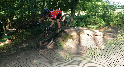
Cross country mountainbike races follow specific trails in the landscape. Those riders, who best know the underground details, are expected to be able riding with faster speed. Riding speed depend on knowing the best riding line and any obstacles like stones, tree branches or roots on the track
Data: Data capturing takes place in the field.
Hypothesis: A micro terrain representation (cm resolution) of a cross country race track enable riders to perform better during races!
Research questions: Which procedure would enable fast capturing of underground condition leading to a Digital Terrain Model (DTM) in a cm spatial resolution? Are two or more GoPro Hero 9 cameras or a DJI drone applicable for track recording in cm resolution? What computer performance is required for each 100 Meter of track DTM analysis?
Objective: To capture the micro topology of a race track on three kilometres length within a few hours. To derive a DTM from single overlapping pictures within a few hours, e.g. with a high performance cloud service. To analyse the DTM to find the best riding line with a 29" wheel size and a given frame size.
References & datasets
As a case study area, the students could use the racetrack used for national competitions in Koppl (10 km to the east of Salzburg). Three GoPro cameras, mounting equipment for e.g. the handlebar, the chest and/or the helmet will be provided. A GNSS System for reference point setup are available, too.
Prerequisites/qualification
Interest in biking and terrain analysis with solid skills in working with big image data.
Planned Start
Any time
No comments:
Post a Comment